
Water Erosion
Daily Dose of Destruction
|
|
|
|
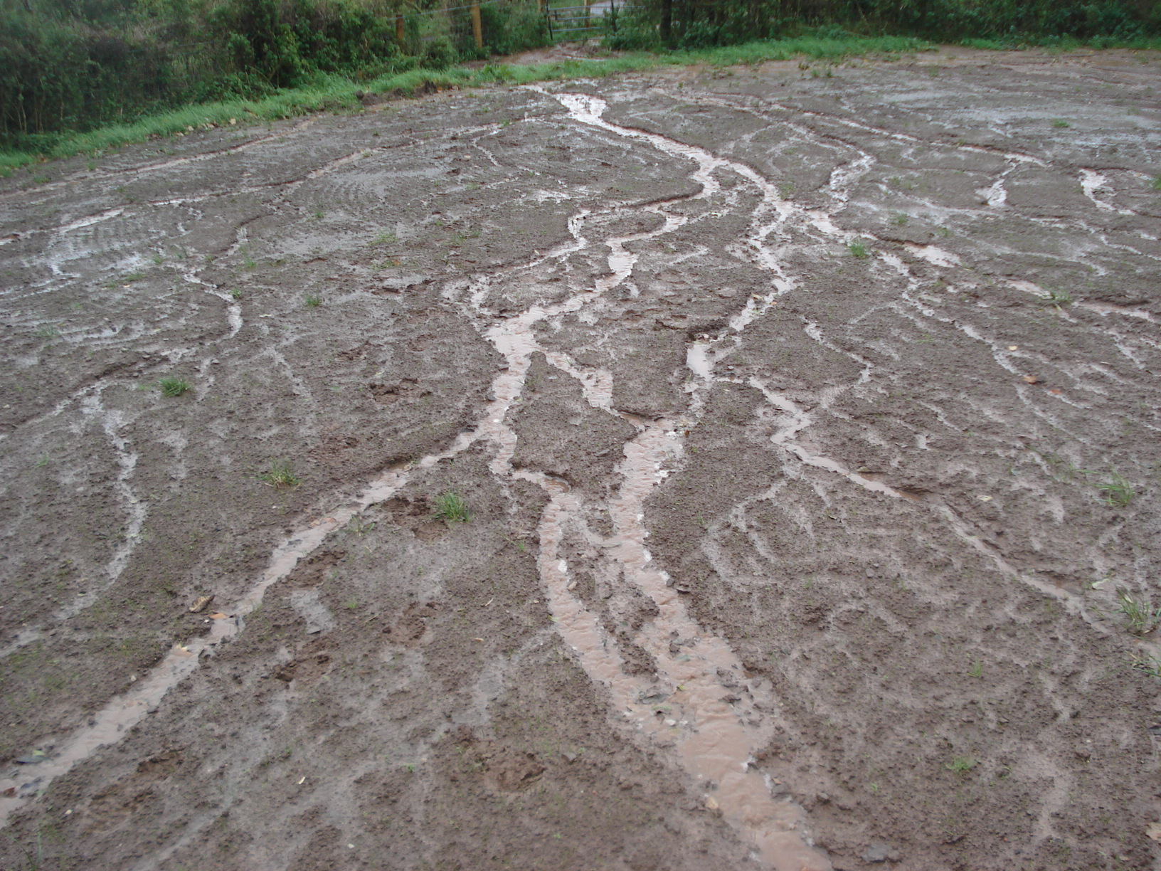
We are going to start out with an observation lab and observe how rivers form and some of the features that they can make. You will need a stream table or a sloped area with sediment on it. Run a steady stream of water down the slope and observe what happens. Below is a lab sheet that you can print off to help you with this lab.
If you are a student at Snowflake, Holbrook or Heber click here to access the SUSD5 Student version of the Exploring River Formation Lab
Purchase this Exploring River Formation Lab at TpT for $0.55 cents.
Section 1: River Erosion
Daily Dose of Destruction
As precipitation hits that ground, gravity forces it to the lowest points possible. As water moves along the surface to its lowest point, it is called runoff. Runoff is simply water that does not soak into the ground or evaporate. Runoff eventually runs into streams, lakes, and oceans.
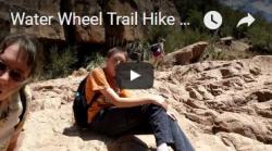
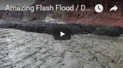
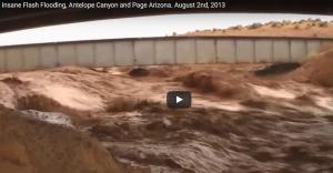
There are some factors that affect the behavior of water runoff. The amount of rain affects runoff. The more precipitation the ground receives in the shortest amount of time possible, the more runoff the Earth will have. The angle at which the ground is sloped will also affect runoff. The steeper the angle of the slope is, the faster the water will run off, which means that the shallower angle the slope is, the more time water has to soak into the ground. The amount of vegetation that the ground contains will determine the rate at which water runs off the land. When fires go through certain areas, vegetation is burned away and this is very dangerous when large amounts of rain hit the area. Water does not get slowed down and can move quickly. When the Water Wheel flash flood occurred in 2017, it brought soot down from a mountain 8 miles away that was burned out previously. When the Rodeo Chedeski fire hit Arizona in 2002 it created huge areas of bald spots. Citizens recognized the danger and began to plant thousands of trees and a lot of grasses hoping to keep the runoff to a minimum.
There are a few types of water erosion:
- Rill erosion: very tiny streams that form during heavy rain.
- Gully erosion: larger and wider than rill erosion. Much more soil is being removed by the water's flow.
- Sheet erosion: Slope is shallow. Shallow water flow removes and deposits soil slowly.
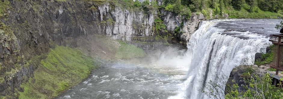
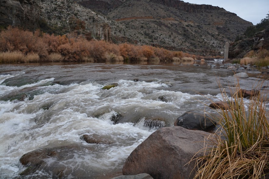
- Stream erosion: This type is the most erosive. Over time, streams tend to widen and deepen as they remove soil and rock from the area.


As erosion by water is happening, the water is carrying what is called the load. The load is nothing more than the sediment that is being transported. There are three types of loads:
- Dissolved load: This load contains minerals that would be hard if not impossible to see. Salt is an example of a mineral that gets dissolved and then transported by a river.
- Suspended load: This type of load contains all the sediment that is visibly floating in the water. Mostly silt and clay.
- Bed load: This load contains the heavier sands, gravel, and boulders that are bounced along the bottom of a river. It takes an energetic river to move sediment like boulders and gravel.

In the following video, you can see sediment being transferred by a river that is coming from the meltwater of a glacier found in an outwash plain. See if you can't find the tiny crab. You will also be able to notice the suspended and bed load.
Many streams slow into fivers. We call all of the streams, washes, rills, and runoff that flows into a single river, a river system. The land that the river takes water from is called the drainage basin. Gravity drains the basin to the lowest point and we call these lowest points, lakes, ponds, seas, and oceans.

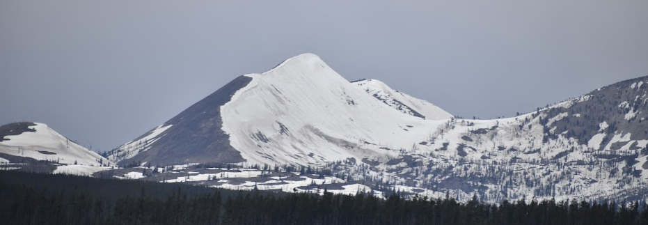
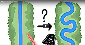
Let's look at stream development. When you did the water formation lab you gained experience in understanding a little about how rivers form. Stream development is going to depend on the slope. Remember, the steeper the slope the faster the river will be able to move. River classification depends on river speed and "bendiness." We classify rivers as young, mature, or old. The classification has nothing to do with the actual age of a river and different parts of the same river can be classified differently.
Young streams and rivers are going to be energetic. You will notice rapids, and waterfalls. Young rivers are going to erode more of the bottom of a river and not so much the sides. They tend to take on a "v" shape.
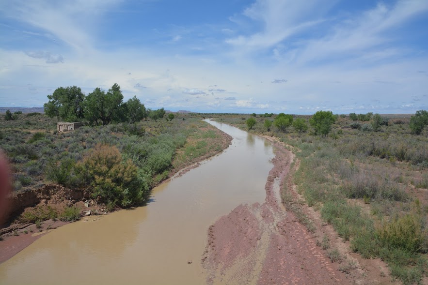
As a river matures, the energy of the river slows down. Much of the rock that causes waterfalls and rapids has been worn down. The sides of the river begin to widen as the banks are worn away. Meanders, large broad curves in a river, are being developed in mature rivers. The outside turn/bank of a river's bend gets eroded faster because the water is moving faster on the outside bank. Meanwhile, the inside bank of a meander has slower water and you notice that the river tends to drop its load on the inside bank. We call this deposition. Mature rivers also begin to form floodplains.
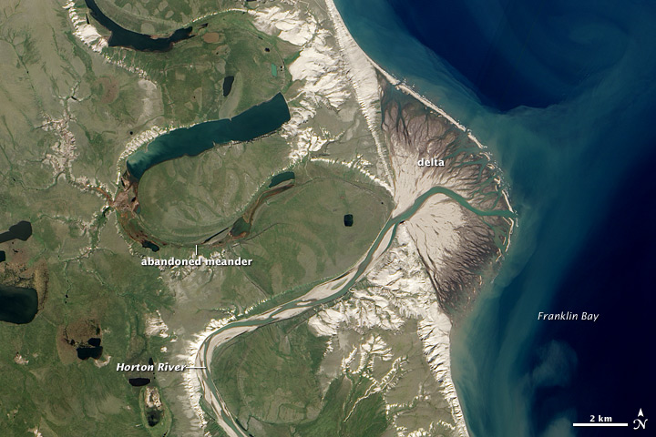
As a river moves from mature to old, the flow creates very large meanders. These meanders in a river can get so large and loopy that the loops will loop so far that the outside bank will run into another loop and join. The water will then bypass one of the loops and abandon it. The abandoned meanders are called oxbow lakes. They take on a crescent shape and during floods will fill with water. Old rivers are going to create very large, broad floodplains.

The following video will demonstrate the formation of rivers.
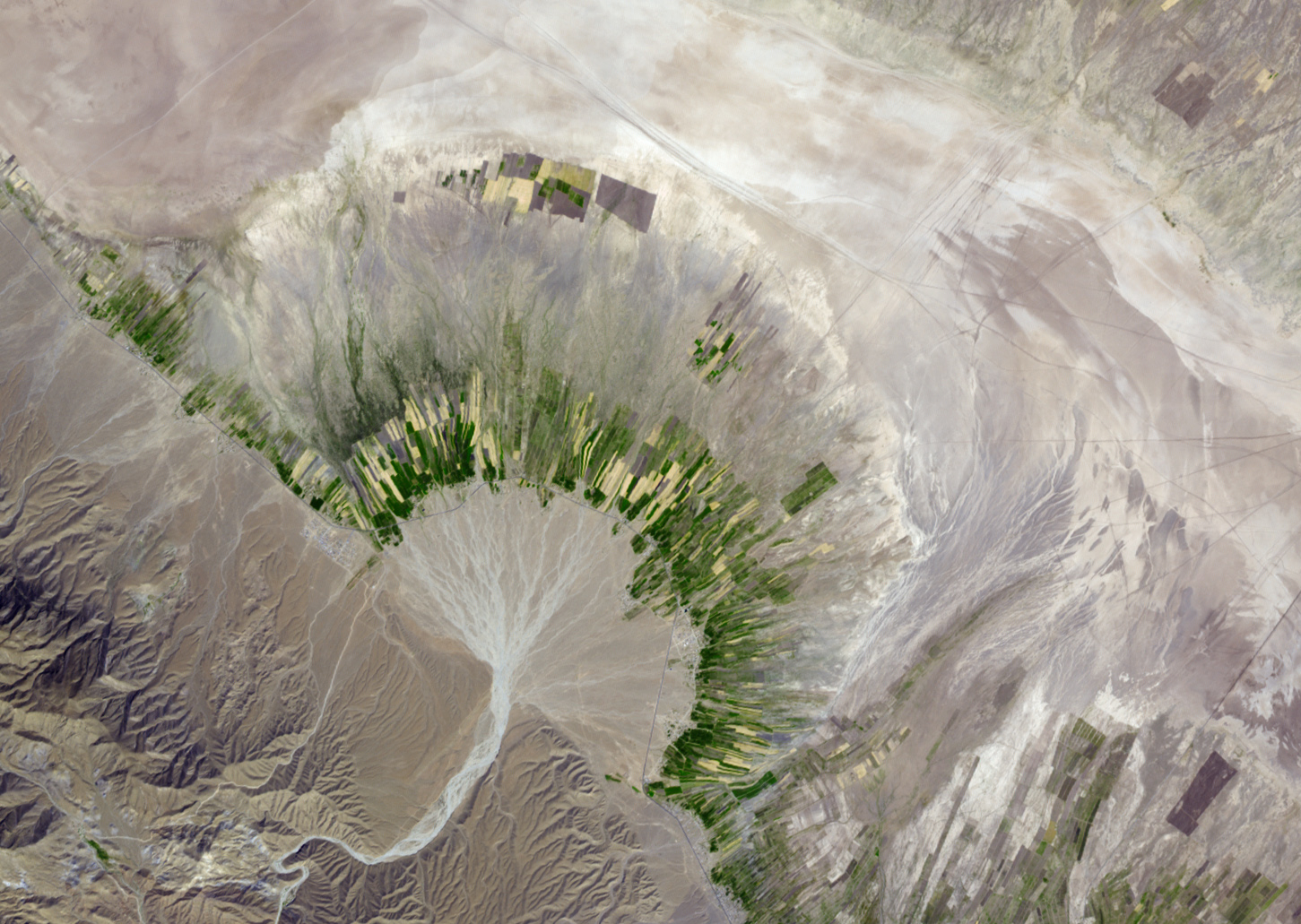
As mentioned earlier, as rivers lose energy they deposit their loads. An alluvial fan is a type of deposit created from mudflows and flash floods. As this fast-moving water leaves the steeper slopes it "throws" the water out into a fan shape. The load is deposited in the shape of a fan. Another type of deposit is called a delta. Deltas are usually shaped like a fan, or like a triangle as well. We call this a delta. In fact, the symbol delta in math is shaped like a triangle. A delta is what is formed at the river's mouth or the lowest point of the river that leads into a lake or an ocean. The largest delta in the USA is where the Mississippi River empties into the Gulf of Mexico.
|
|
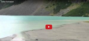
This next video demonstrates how a delta is being formed in Lake Louise, Canada.
In the following activity, you are going to use Google Earth to see some real-life locations and examples of water erosion landforms discussed in this section.
If you are a student at Snowflake, Holbrook or Heber click here to access the SUSD5 student version of this Water Landform Google Earth Scavenger Hunt activity.
Section 2: Ground Water
Daily Dose of Destruction
In this section, we are going to learn how water moves underground.
For this next lab you will need to understand two words:
- Permeability: The ability of water to soak and flow through sediment and rock.
- Porosity: A measure of how much open space there is in rock and sediment.
- Substrate: A layer that underlies something or on which a process occurs
You are going to design an experiment that answers this question: Which substrate has the highest permeability and which has the highest porosity?
If you are a student at Snowflake, Holbrook or Heber click here to access the SUSD5 Student version of the Soil Permeability Lab
Purchase this Soil Permeability and Porosity lab from Teachers Pay Teachers for $0.80 cents.
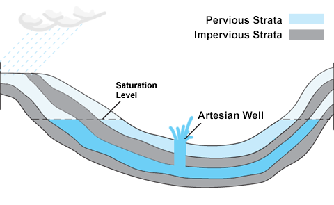
The ground is part of the water system. After you have completed the lab above you should have found out that clay sediment is the least permeable sediment. Solid rock is the most impermeable. Sandy sediment and broken rock are the most permeable. Due to gravity, water is always trying to get to the center of the Earth and it does this well until it hits a layer of impermeable rock. Water then soaks into all the pores above creating what we call an aquifer. When the layer is completely saturated with water we call it the zone of saturation. The water table is at the top of the zone of saturation. In order for a well to work, it must be dug below the water table. If there are too many wells tapped into the water table or if dry seasons are long, the water table can lower.
There is a really cool type of natural well called an artesian well. Artesian wells don't need to be pumped because they are under constant pressure. These wells are formed between two impermeable layers with a downhill slope. You can see in the image below how an artesian well works.
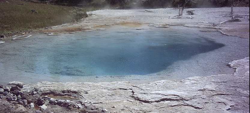
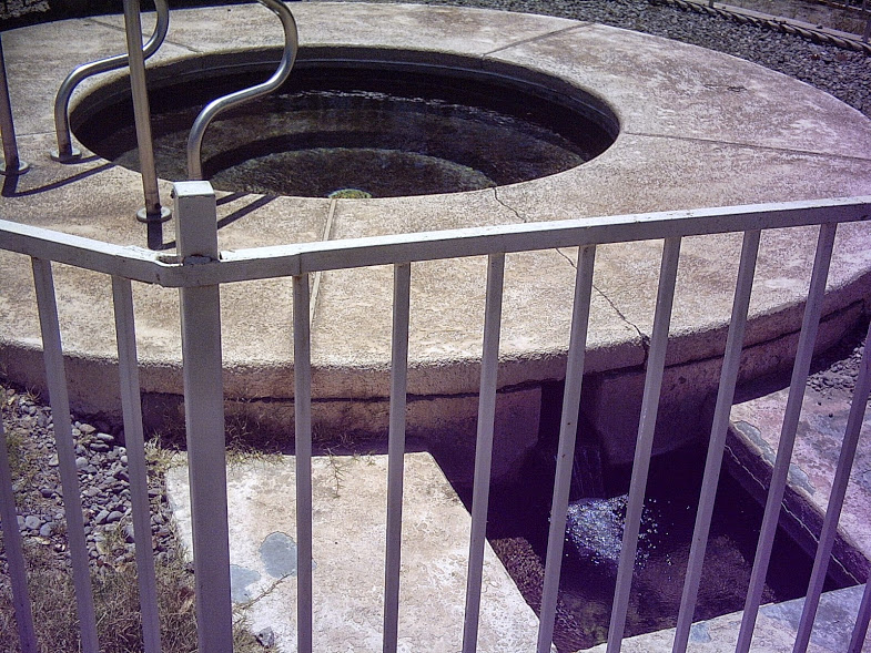
A spring occurs where the water table meets the Earth's surface. Springs are found on and around hills. They serve as a source of fresh water. Hot springs are formed from water that is heated by geothermal anomalies. Most springs are natural but sometimes they can be manmade either on purpose or by accident. Hot Dunes Recreation area located near Safford, AZ was created because of people trying to dig for oil and ended up puncturing a hole through an impermeable rock layer releasing the pressure of an artesian well. It has now watered this desert area creating its own oasis and river.
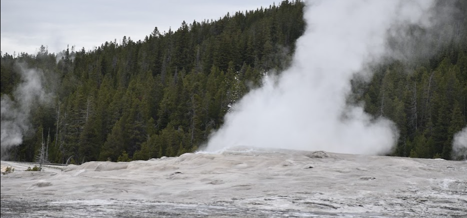
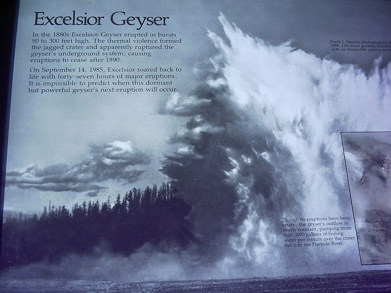
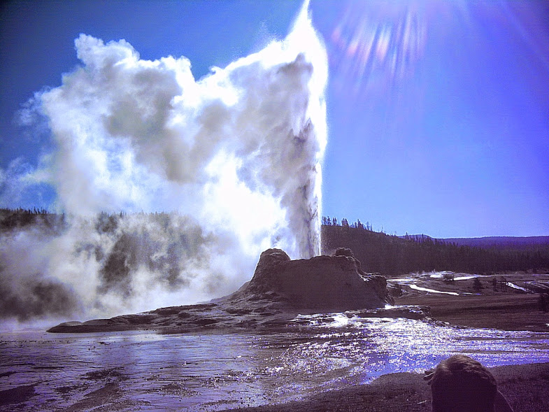
Geysers are another type of feature caused by heated groundwater. Geysers are hot springs that periodically erupt. They erupt because groundwater is heated, boils, expands, builds up pressure, and then flashes into steam. All of that pressure then finds paths in the cracks that reach the surface. Old Faithful is an example of a geyser. It can shoot 40,000 liters of water at one time into the air.
|
|
|
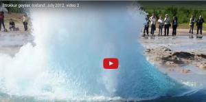
This next video demonstrates an awesome geyser found in Iceland.
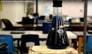
If you have ever wanted to build your own geyser, below is a video that demonstrates a homemade version.
Using the next two links you can see some awesome videos put out by Yellowstone National Park.
We are going to do an in-depth study of some of the features you would and will find in Yellowstone. Why? Because it is awesome.
Below is a link to the instructions and the rubric by which this activity will be graded.
If you are a student at Snowflake, Holbrook or Heber click here to access the SUSD5 Student version of the Yellowstone Water Features research presentation.
Purchase this activity through Teachers Pay Teachers for 0.50 cents.
Section 3: Caves, Sinkholes, and Ocean Shore Erosion
Daily Dose of Destruction
|
|
|
Before we get into the different features of caves, you are going to need to do some more research. In the following assignment, you are going to choose or be assigned one awesome cave in this world. You will create a Google doc shared between you, a partner, and your teacher, that contains the answers to 8 questions about your cave. Below is the link to the assignment.
If you are a student at Snowflake, Holbrook or Heber click here to access the SUSD5 Student Version of the Cave Formation in Information assignment
Purchase this Cave Information Activity at Teachers Pay Teachers for 0.50 cents.
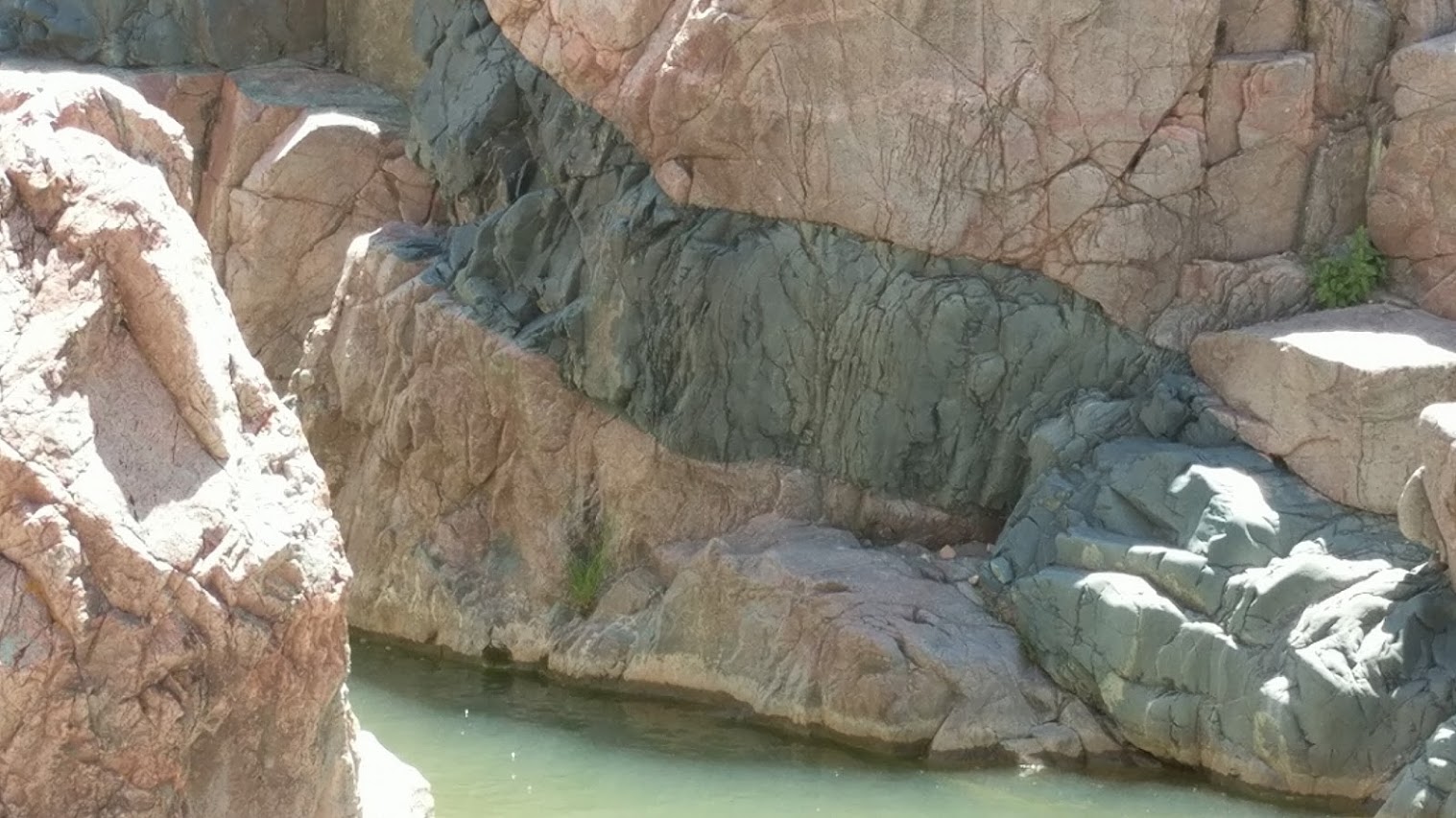
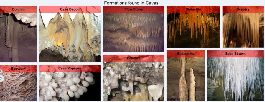
Caves are formed by a mixture of water and carbon dioxide which when combined together form a weak acid called carbonic acid. The carbonic acid eats away at the weaker parts of rock like limestone which gets washed away by water. There are many formations found in caves. Formations are caused by the chemical deposition of sediment and chemicals from the rock. An example is that when limestone is affected by carbonic acid, it can create a new chemical sedimentary rock called travertine.
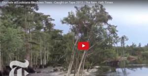
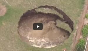
If the ceiling of a cave collapses we a sinkhole appears.

Section 4: Shorelines
Daily Dose of Destruction
Shorelines are constantly changing in their appearance. Tides and waves help shape these shorelines causing both weathering and erosion. There is a type of ocean current called a longshore current that runs parallel to the shore carrying sediment away from its original position. Surface waves break and deposit material, constantly rolling the sediment up and down the beach, weathering the sediment into even smaller pieces.
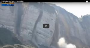
Rocky shorelines go through a process called shore straightening. Let's imagine an ocean shore that is made out of a cliff, called a headland. Ocean waves tear into the cliff through physical weathering and chemical weathering. The waves beat on the cliff 24 hours a day throwing salt onto the rock that chemically weakens it. As it rips into the cliff it creates wave-cut cliffs. These cliffs over time tend to form caves. If the ocean eats through an entire cliff to the other side, a sea arch might be formed. As the arch becomes thinner due to the constant pounding of the waves, it might collapse forming sea stacks. The sea stack continues to weather until all the material has been eroded away, eventually disappearing below the ocean. The image below depicts this process.
|
|
|


Sandy beaches are just deposits of sediment that run parallel to the shore. Natural sandy beaches only go inland as far inland as the tide goes. Not all beaches are sandy. Beaches can be made out of sand in multiple colors, seashells, and gravel. The beaches are made from the weathered rock of a particular area.
Given enough time, beaches can be eroded away, so humans have responded to this by creating seawalls and jetties.
|
|
|


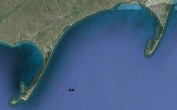
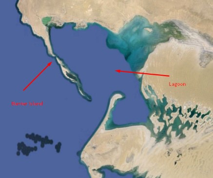
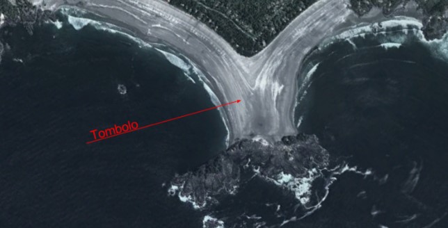
Some natural landforms created by oceans are tombolos, spits, barrier islands, lagoons, and bays.
|
|
|
|
|