
Section 1: Understanding Weather Fronts Using Surface Maps
Daily Dose of Destruction: Ice Storms
|
|
|


If are a student at Snowflake, Holbrook or Heber click to access the SUSD5 version of the Understanding Weather Fronts using Surface Maps assignment
Purchase the Understanding Weather Fronts using Surface Maps assignment for $2.00 at Teachers Pay Teachers(Now comes with a digital Easel TpT activity)
Air temperature determines what type of precipitation an area will receive. There are 4 types: rain, sleet, hail, and snow. Precipitation occurs after condensation has happened and the air is no longer able to keep the moisture aloft. Rain occurs when liquid waterfalls. The larger the raindrops the more time the liquid stayed within the cloud gaining mass. Snow occurs when water vapor changes to a solid. Sleet happens when snow passes through a warm layer of air, melts, and then freezes as it approaches the ground. Freezing rain can happen when rain falls through the atmosphere and hits frigid air close to the surface so that the moment it hits an object it freezes. Hail is formed in cumulonimbus clouds as water drops rise and fall through the cloud collecting moisture at the base of the cloud and freezing near the top of the cloud. Remember cumulonimbus clouds can get to about 18,000 meters or 60,000 feet.
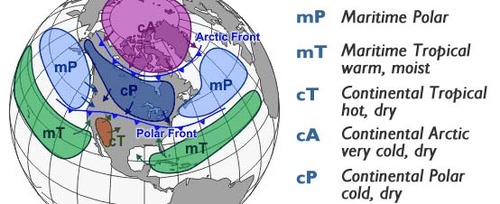
Air masses are large bodies of air that have relatively the same temperature and humidity. Their temperature and humidity are based on where they come in from. Air masses determine the changes in weather.
North American Air Masses Coming From:
- Over Ocean: maritime (m)
- Overland: continental (c)
- Way up north: Arctic (A)
- From the north: Polar (P)
- From the south: Tropical (T)
So if an air mass came from over an ocean in the north you would call the air mass Maritime polar or mP and bring in cold wet air. An air mass that came from the south and over a continent would be called Continental tropical or cT and would bring in warm dry air.
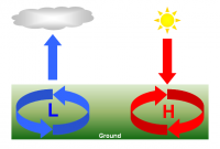
Remember that atmospheric pressure affects weather patterns as well. High pressure occurs when heavy air sinks making cloud formation difficult therefore the area would have clear weather. Low pressure occurs when less dense air rises quickly taking moisture with it causing cloud growth and eventually stormy weather.
Weather fronts are boundaries between two different air masses. Stormy weather happens at these boundaries. Air masses with different temperatures don’t mix. Cold fronts happen when a cooler air mass moves under a warm air mass causing air to rise and eventually condensate. Cold fronts on a weather map are symbolized with a string of blue triangles. Cold fronts tend to cause stormy weather and contain cumulus and cumulonimbus clouds.
![]()

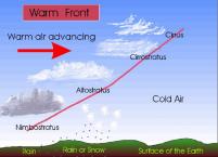
Warm fronts happen when a warmer air mass moves over a cooler air mass, rising relatively slowly. Warm fronts are going to have wide bands of precipitation and be preceded by high cirrus clouds. These types of fronts are symbolized as a string of red lumps.
![]()
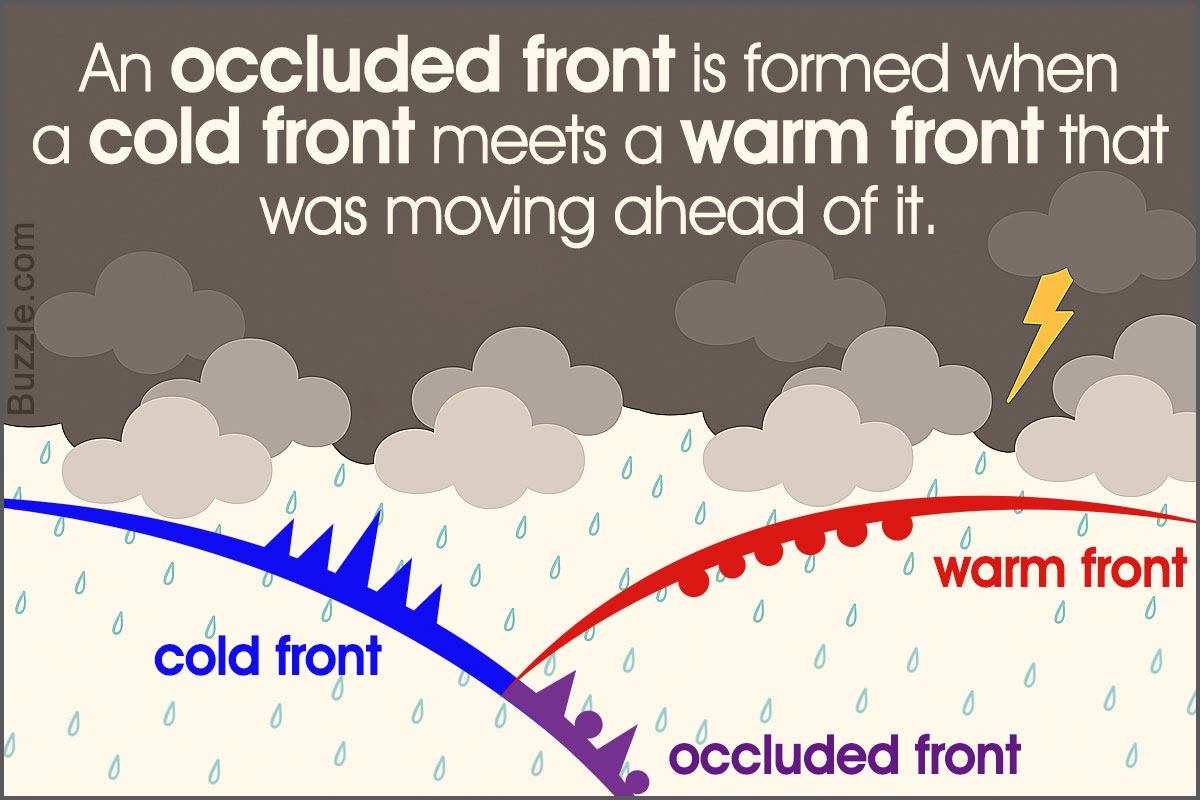
An occluded front happens when two cold air masses merge together pinching warmer air and causing it to rise. Strong wind and heavy precipitation can occur. Occluded fronts are symbolized with purple triangles and lumps.
![]()
The last type of front is called a stationary front. Air pressure differences cause a warm front or cold front to stop moving. These types of fronts can stay in one place for days. Weather along these fronts includes light wind and precipitation. Stationary fronts are symbolized by a string of red lumps and blue triangles.

![]()
Going to this site, http://earthscience.xyz/Surface2 will allow you to check out all the weather fronts that are occurring in the United States. Now that you understand the different types of weather you can practice understanding them by analyzing a surface weather map. You can also use the 12, 24, 36, and 48-hour forecasts to see how these types of fronts change over periods of time.